Overview
This is one of the 20 stages of the GM Ringway – the new walking trail for Greater Manchester. GM Ringway Stage 10 (Newhey – Littleborough) explores classic South Pennines scenery including another section of the Pennine Way.
Note also that walkers with vertigo may find the footbridge over the M62 rather challenging. A diversionary route is shown on the Plotaroute map.
Note that parts of the trail may be damp, muddy and slippery at any time of year and especially after periods of wet weather. Please bear this in mind when planning your trip.
Map and directions
This walk is available (without written directions) on the mobile-friendly Plotaroute app. To use Plotaroute on your phone’s browser, simply click the map. Then, when you’re ready to start walking, click the tracker icon (bottom right) to show your position as you follow the route. We recommend carrying an additional power source and/or map when following online routes on your phone.
Feedback on the route
To give any feedback or notify us of any issues with this route, please click on the button below
Highlights include
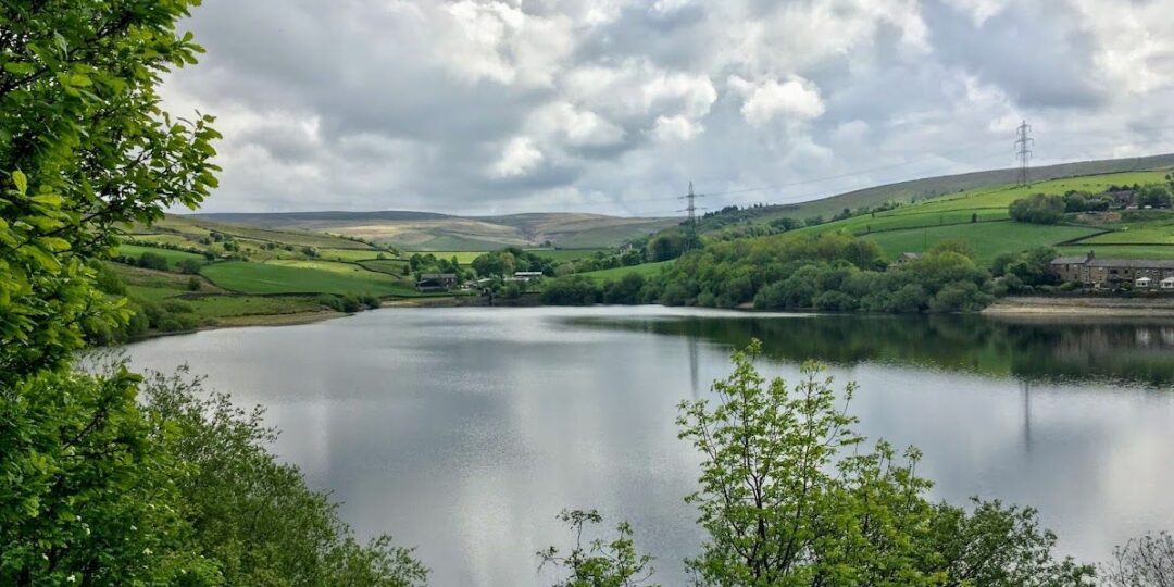
– Lovely views over the chain of reservoirs in the Piethorne Valley
– A grassy ridge walk along the well-named Windy Hills, offering aerial views of Britain’s highest motorway
– The dramatic rocks of Blackstone Edge, called the “Andes of England” by Daniel Defoe
– A descent of the “Roman Road”, actually a medieval packhorse trail
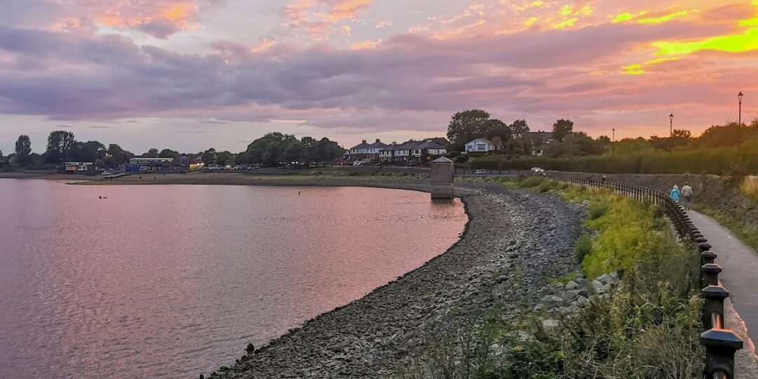
– A gentle finish via the tree-lined Ealees Valley and the shores of Hollingworth Lake, Greater Manchester’s largest body of water.
Accessibility and facilities
– Cafe or pub nearby
– Dogs permitted (on a lead)
– Toilet facilities
– Transport via Metrolink, bus, or train
The route includes a considerable amount of ascent (481 m / 1578 ft) and descent and crosses high ground. Paths are generally good, though sections are likely to be muddy or boggy depending on the season. The walk, which is suitable for experienced walkers with navigation and map-reading skills, would be challenging in poor visibility. Because of the varied terrain, the overall walk is not wheelchair or pushchair-friendly. However, a step-free route is available around Hollingworth Lake near the end of this stage. We will be adding step-free and shorter walks on parts of the GM Ringway over the next few months.
There are facilities at the start and towards the end of the route at Hollingworth Lake. Shops, cafes and pubs close to the route are shown on the Plotaroute map.
How to get there
Start point Newhey Metrolink station
View start point on Google maps
End point Littleborough train station
All stages of the GM Ringway can be accessed by public transport. This stage links Newhey Metrolink station, served by trams from Rochdale, Oldham and Manchester, with Littleborough station, served by regular trains to Rochdale and Manchester.
To work out how to get to and from the walk start and end points, click the Google Maps links on this page. Then click ‘Directions’ and enter your postcode or location in the relevant field. Then, for public transport options, click the train icon. Alternatively, input the postcodes shown on this page into the Traveline journey planner.