Overview
This is one of the 20 stages of the GM Ringway – the new walking trail for Greater Manchester.
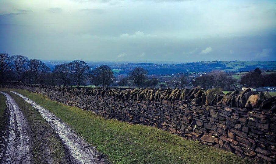
GM Ringway Stage 6 (Strines – Marple) includes a fantastic mix of canalside, moorland and valley scenery with stunning Peak District views.
There are two main ascents, notably the climb onto Mellor Moor, and the ascent, largely up steps, after crossing the ‘Roman Bridge’ across the River Goyt. Apart from that, most paths are level or downhill. Mud and puddles are likely on certain sections.
Note that parts of the trail may be damp, muddy and slippery at any time of year and especially after periods of wet weather. Please bear this in mind when planning your trip.
Map and directions
This walk is available on the user-friendly Go Jauntly walking app. Here, photographs and written directions will enable you to follow the route on your phone. You can also download a printable PDF of the directions from the same link.
Alternatively, you can follow the route (without written directions) on the mobile-friendly Plotaroute app. To use Plotaroute on your phone’s browser, simply click the map. Then, when you’re ready to start walking, click the tracker icon (bottom right) to show your position as you follow the route.
We recommend carrying an additional power source and/or map when following online routes on your phone. For any challenging routes, we would recommend that you also have access to and know how to read an Ordnance Survey map.
Feedback on the route
To give any feedback or notify us of any issues with this route, please click on the button below
Highlights include
– The hamlet of Brookbottom with its traditional country pub
– An exploration of Mellor Moor, a high plateau offering stunning views, with one of the two highest summits in Stockport borough
– Mellor village, with its Iron Age archeological site and church with the oldest wooden pulpit in England
– The ‘Roman Lakes’, a Victorian beauty spot in the picturesque Goyt Valley
– The famous flight of locks at Marple.
Accessibility and facilities
– Cafe or pub nearby
– Dogs permitted (on a lead)
– Transport via bus or train
The ascents and the varied terrain on this stage mean that the overall walk is not wheelchair or pushchair-friendly. We will be adding step-free and shorter walks on parts of the GM Ringway over the next few months.
There are no public toilets along the route, but there are pubs at Brookbottom and in Mellor Village as well as several pubs and cafes in Marple Bridge to the east of Marple station.

How to get there
Start point Strines train station SK22 3AL
View start point on Google maps
End point Marple train station
All stages of the GM Ringway can be accessed by public transport. This stage links Strines and Marple train stations, both on the same line from Manchester to New Mills and Sheffield. Both the start and the end of the route can also be accessed by bus to and from Stockport town centre.
To work out how to get to and from the walk start and end points, click the Google Maps links on this page. Then click ‘Directions’ and enter your postcode or location in the relevant field. Then, for public transport options, click the train icon. Alternatively, input the postcodes shown on this page into the Traveline journey planner.