Overview
Stage 1 of the GM Ringway trail uses canal towpaths, paths, parkland and the Trans Pennine Trail to trace an almost totally traffic-free route from the city centre to the greenbelt of the Mersey Valley.
This route has now been improved (in summer 2023) to avoid any diversion on match days at Old Trafford and to make it even more traffic-free. Also, despite its name, this stage takes you only to the Sale Water Park Metrolink station. Sale Water Park itself is actually explored on Stage 19 (Altrincham – Stretford), the penultimate stage of the GM Ringway.
Note that parts of the trail may be damp, muddy and slippery at any time of year and especially after periods of wet weather. Please bear this in mind when planning your trip.
Map and directions
This walk is available on the user-friendly Go Jauntly walking app. Here, photographs and written directions will enable you to follow the route on your phone. You can also download a printable PDF of the directions from the same link.
Alternatively, you can follow the route (without written directions) on the mobile-friendly Plotaroute app. To use Plotaroute on your phone’s browser, simply click the map. Then, when you’re ready to start walking, click the tracker icon (bottom right) to show your position as you follow the route.
We recommend carrying an additional power source and/or map when following online routes on your phone. For any challenging routes, we would recommend that you also have access to and know how to read an Ordnance Survey map.
Feedback on the route
To give any feedback or notify us of any issues with this route, please click on the button below
Highlights include
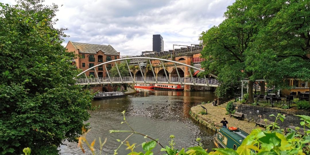
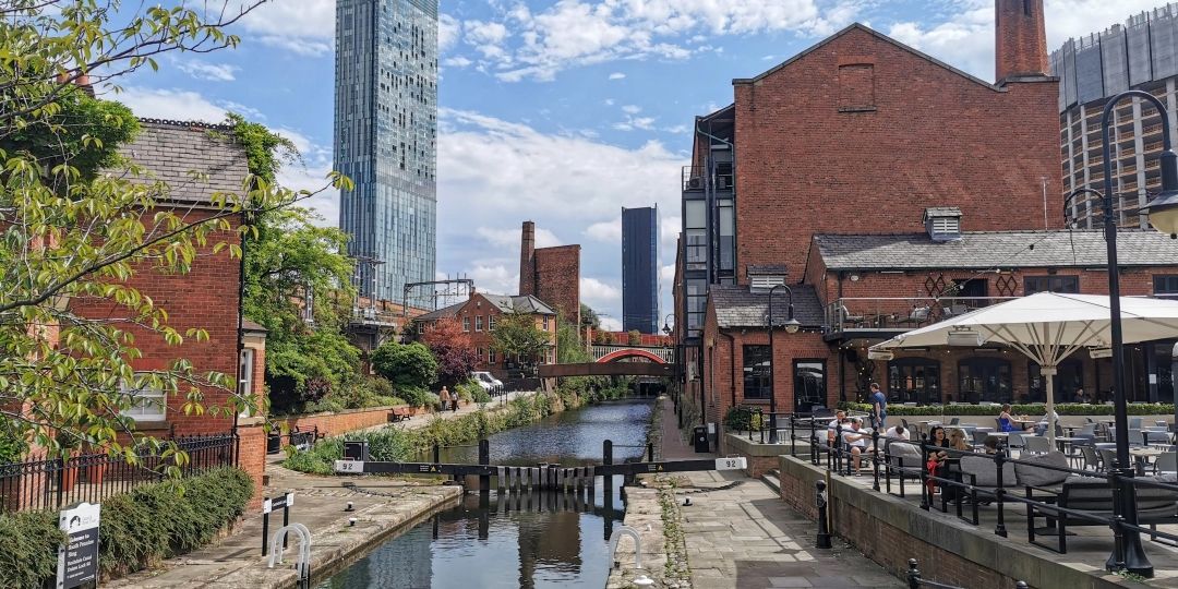
- The towpaths of the historic Rochdale and Bridgewater Canals
- Castlefield‘s industrial and transport-related heritage
- Iconic sports grounds at Old Trafford
- Longford Park, with its petting zoo, cafe and play areas
- The paths and lanes of Turn Moss and the Mersey Valley greenbelt.
Accessibility and facilities
– Toilet facilities
– Cafe or pub nearby
– Dogs permitted (on a lead)
Most of the paths are very well-made and level, though there are steps when you leave the Bridgewater Canal, some short slopes along the canal, and a brief potentially muddy section in Turn Moss. Because of these factors, the complete walk is not wheelchair or pushchair-friendly. We will be adding step-free and shorter walks on parts of the GM Ringway over the next few months.
Public toilets including accessible facilities are available in the Town Hall Extension and in the Central Library (Monday to Saturday) near the start, at the cafe in Longford Park and at the end in nearby Sale Water Park. Apart from in the city centre, refreshment opportunities are marked on the Plotaroute map.
How to get there
Start point St Peter’s Square Metrolink M2 5PD
View start point on Google maps
End point Sale Water Park Metrolink M33 2LX
All stages of the GM Ringway can be accessed by public transport. This stage begins at St Peter’s Square Metrolink station and there are several bus and train services nearby. The stage finishes at Sale Water Park Metrolink. Currently (early 2023), passengers are allowed to travel with their dogs on Metrolink trams. However, if this is no longer possible, walkers with dogs can use bus services from either Sale or Chorlton to return to Manchester or elsewhere as shown on the Plotaroute map.
To work out how to get to and from the walk start and end points, click the Google Maps links on this page. Then click ‘Directions’ and enter your postcode or location in the relevant field. Then, for public transport options, click the train icon. Alternatively, input the postcodes shown on this page into the Moovit journey planner app.