Overview
This is one of the 20 stages of the GM Ringway – the new walking trail for Greater Manchester. Stage 16 connects Wigan and Leigh town centres via England’s newest National Nature Reserve. The reserve – officially, the ‘Flashes of Wigan and Leigh’ – was formally designated in October 2022 in recognition of the area’s natural beauty and immense ecological importance.
After extended periods of rain, you are advised to use the diversion shown between the 5 and 6-mile point to avoid a waterlogged area. This detour is shown on the Plotaroute map.
Note that parts of the trail may be damp, muddy and slippery at any time of year and especially after periods of wet weather. Please bear this in mind when planning your trip.
Map and directions
This walk is available on the user-friendly Go Jauntly walking app. Here, photographs and written directions will enable you to follow the route on your phone. You can also download a printable PDF of the directions from the same link.
Alternatively, you can follow the route (without written directions) on the mobile-friendly Plotaroute app. To use Plotaroute on your phone’s browser, simply click the map. Then, when you’re ready to start walking, click the tracker icon (bottom right) to show your position as you follow the route.
We recommend carrying an additional power source and/or map when following online routes on your phone. For any challenging routes, we would recommend that you also have access to and know how to read an Ordnance Survey map.
Feedback on the route
To give any feedback or notify us of any issues with this route, please click on the button below
Highlights include
– Wigan’s historic industrial sites including Trencherfield Mill and the site of Wigan Pier, made famous by George Orwell
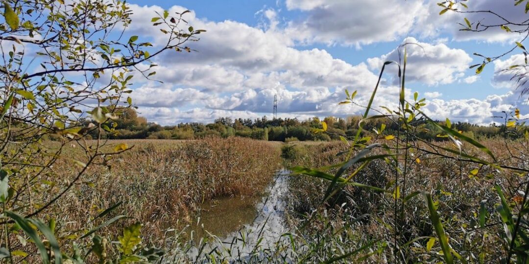
– The Leigh Branch of the Leeds & Liverpool Canal, including a delightful section running between two of the largest flashes (lakes formed as a result of mining subsidence)
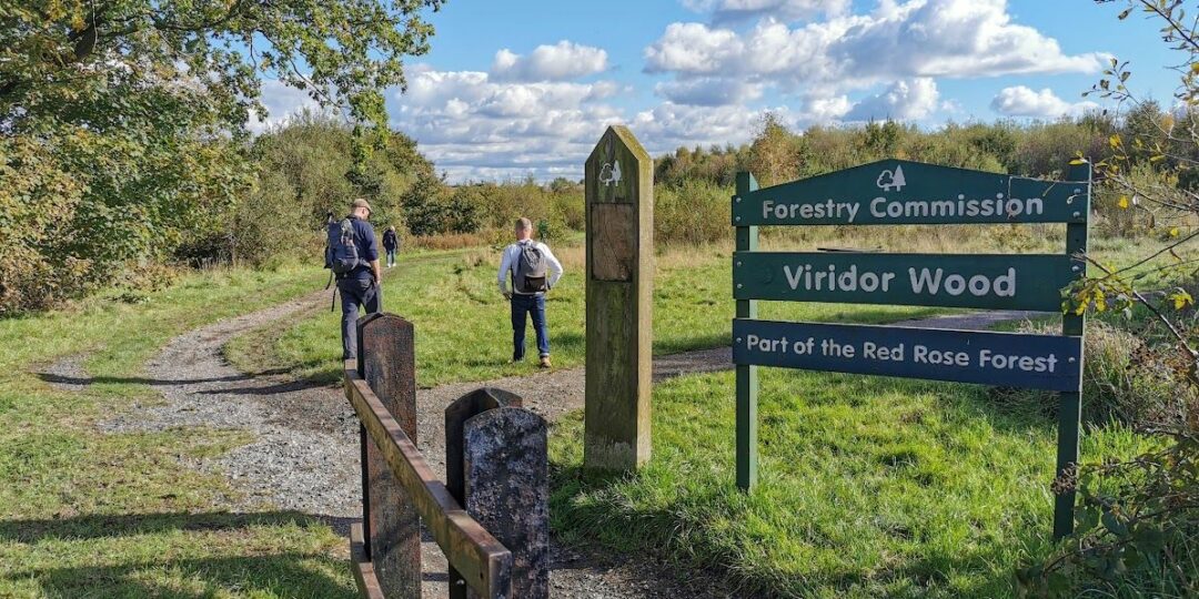
– Some lesser-known countryside, including the fringes of Three Sisters country park and the mixed woodland of Viridor Wood
– Lightshaw Meadows, an area of grassland that has been designated as an SSSI (Site of Special Scientific Interest) thanks to its rich variety of flora and fauna
– Pennington Flash, nationally renowned for its birdlife, and the second-largest body of water in Greater Manchester.
Accessibility and facilities
– Cafe or pub nearby
– Dogs permitted (on a lead)
– Toilet facilities
– Transport via bus, or train
The route is almost totally level and most paths are of good quality. However, careful attention to the map is needed in places and there may well be muddy or damp sections.
Because of the varied terrain, the overall walk is not wheelchair or pushchair-friendly. However, there are level and barrier-free paths (not all of which are well-surfaced) along the canal and on the eastern and northeastern edge of Pennington Flash. We will be adding step-free and shorter walks on parts of the GM Ringway over the next few months.
Toilet facilities are available for customers at the various cafes and pubs shown on the Plotaroute map. Note that the pub shown on some maps at Dover Bridge south of Abram has been closed for some years. Accessible toilets are available at Wigan North Western station and at Pennington Flash.
How to get there
Start point Wigan stations WN1 1BA
View start point on Google maps
End point Leigh bus station WN7 4LP
All stages of the GM Ringway can be accessed by public transport. This stage links the two train stations in Wigan (Wallgate and North Western) with Leigh bus station, served by frequent buses from Wigan, Bolton, Manchester and other locations.
To work out how to get to and from the walk start and end points, click the Google Maps links on this page. Then click ‘Directions’ and enter your postcode or location in the relevant field. Then, for public transport options, click the train icon. Alternatively, input the postcodes shown on this page into the Moovit app journey planner.