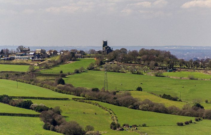
The Mottram Hill Trail is a moderate four-mile circular walk linking hilltop and valley. It offers fine views over Longdendale into the Dark Peak of Derbyshire.
Along the way, a short detour to Mottram Church is recommended. Dominating the village of Mottram and the countryside around, “The Cathedral of East Cheshire”, as it was once described, was erected in the 15th century and restored in the 1850s.
As this walk guide does not include a map, we would advise you to also use the relevant OS Explorer maps or the OS mapping app.
Accessibility and facilities
As the walk involves a variety of terrain and some gradients, it is not rated as suitable for wheelchair users and those with pushchairs. While there is no public toilet on the walk route, the Lymefield Garden Centre, open seven days a week, is close to the start point and offers a café and toilets for customers. Pubs are also available in Mottram and Broadbottom.
How to get there
The start point named in the leaflet (the visitor centre) is now the Lymefield Arts and Crafts Centre, and is given as the main start point on this page. This is only a short walk from Broadbottom train station.
To work out how to get to and from the walk start point, simply click the Google Maps link(s) on this page. Then click ‘Directions’ and enter your postcode or location in the relevant field. For public transport options, click the train icon.