Crossing point – a walk around Saddleworth in the South Pennines
6 miles long
Overview
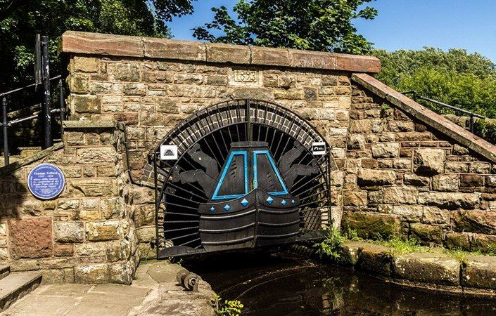
This is a walk in the Royal Geographical Society’s “Discovering Britain” series. It explores some of the routes over and under the South Pennines in Saddleworth, between Oldham and Huddersfield. The landscape is full of fords and bridges, tunnels and cuttings, tracks and towpaths, locks and viaducts, coaching inns and toll houses.
Follow in the footsteps of Roman soldiers, medieval monks and loaded pack horses. Trace the development of the road network and find out how a record-breaking canal and railway tunnels were constructed through the steep hills.
Peel back the layers and discover 2,000 years of history.
Follow the trail by using the map, downloadable guide or audio guide provided on the Discovering Britain web page.
Accessibility and facilities
Despite its moderate length, this walk is rated as challenging because of the ascent from Diggle and the descent back to Standedge. These factors plus the mixed terrain involved make it unsuitable for wheelchair-users and families with pushchairs.
While there are public toilets only at the finish point (Brownhill Countryside Centre), there are several cafes and pubs along the route. Some of these are listed in the downloadable written guide, but note that details may have changed since the time of writing.
How to get there
The walk starts in the village of Delph (served by buses) and finishes at the Browncross Countryside Centre near Uppermill. Both locations are served by regular buses from Greenfield train station and are linked by bus.
To work out how to get to and from the walk start and end points, simply click the Google Maps links shown on this page. Then click ‘Directions’ and enter your postcode or location in the relevant field. For public transport options, click the train icon.