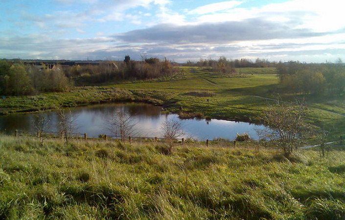
Eatock Lodge Local Nature Reserve is situated within a residential housing area to the south of Westhoughton. It occupies the industrial heritage site of Eatock Colliery, with the pit lodge (a Lancashire word for industrial pond) and former spoil heaps still dominating the landscape.
This green oasis surrounded by housing provides not only a recreational resource for short local walks but is rich in wildlife, leading to the site being declared a ‘local nature reserve’ in 2004. The main features of the reserve are the colliery spoil heaps and lodge, which have seen some alteration since the site was reclaimed in the 1970s. This area of Westhoughton was once agricultural land with numerous ponds and ditches which provided habitat for one of the best amphibian breeding areas in the North West. Eatock Lodge LNR is one of the few remaining sites accommodating the remaining populations of Common Frog and Common Toad. Other habitats present include two small ponds with ditches, native woodlands, extensive hedgerows and areas of acid grassland and flowers.
Accessiblity
A formal footpath network provides short circular walks around the site. We believe that many of the paths are well-paved and suitable for wheelchairs and pushchairs but have not been able to verify conditions on site. While most entrances are steep or have steps, access from The Hoskers is level and provides access to the main path network.
Visitors arriving by train at Daisy Hill Station can also walk to the site via a 1¼-km (3/4-mile) route from the station via Leigh Road – Hartford Road – Hindley Road – France Street – The Hoskers. Note, however, that there is no step-free access to and from the platform at Daisy Hill. Adding this there-and-back route to the circuit of the nature reserve will create a walk of 2 miles/3 km.
How to get there
To work out how to get to and from the walk start point, simply click the Google Maps link on this page. Then click ‘Directions’ and enter your postcode or location in the relevant field. For public transport options, click the train icon.