The Fred Perry Way is a 14-mile walking route which spans Stockport Borough, from Reddish in the north to Woodford in the south.
The route combines rural footpaths, quiet lanes and river valleys with urban landscapes and parklands. Interesting features of the route include:
Houldsworth Mill and Square
the start of the River Mersey at the confluence of the River Tame and River Goyt
Stockport Town Centre
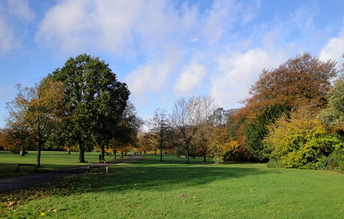
Vernon and Woodbank Parks
Happy Valley Nature Reserve
Fred Perry was one of Stockport’s most famous sons and was born in Portwood in 1909. He won the men’s singles at Wimbledon in 1934, 1935 and 1936. He was the last English men’s tennis player to win the title. Fred Perry was also a member of Britain’s winning Davis Cup team from 1933 to 1936. He was made a freeman of Stockport in 1934.
The Fred Perry Way could easily be tackled in shorter sections, as there are frequent buses and trains back to Stockport town centre along the route. On this page, you can download maps of the southern and northern sections to help you on your walk.
Accessibility
As much of the route follows urban roads and paths, we have marked it as wheelchair and pushchair-friendly. Note, however, that the more rural sections are unlikely to be fully accessible and that we have been unable to verify conditions on the ground.
How to get there
We have given the northern end of the walk (North Reddish Park) as the start point and the southernmost point (Wilmslow Road in Woodford) as the end point. You could easily reverse the route, however, or simply walk individual sections as you wish. Train stations close to the route include Reddish North, Stockport, Hazel Grove, Woodsmoor and Bramhall.
To work out how to get to and from the walk start point and end point, simply click the Google Maps links shown on this page. Then click ‘Directions’ and enter your postcode or location in the relevant field. For public transport options, click the train icon.