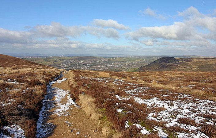
The Harridge Round is a strenuous five-mile walk starting from Castle Clough car park, Carrbrook. The route follows the side of the Tame Valley and coninues up the Brushes Valley before crossing open moorland on a good track to descend back into Carrbrook village. A walk for a fine day with superb views throughout.
Harridge is a shortening of Hare Ridge, and mountain hares, which turn white in winter, have been seen in this area.
Because of the wild nature of the route, we would strongly advise you to also use the relevant OS Explorer maps or the OS mapping app.
Accessibility and facilities
As the walk is a challenging and hilly one, it is not rated as suitable for wheelchair users and those with pushchairs.
There are no public toilets or other facilities along the route.
How to get there
The main start point shown on this page and given in the leaflet is Castle Clough car park, for Stalybridge Country Park.
To work out how to get to and from the walk start point, simply click the Google Maps link on this page. Then click ‘Directions’ and enter your postcode or location in the relevant field. For public transport options, click on the train icon.