The Kingfisher Trail is a scenic 14-mile route connecting the rural West Pennine Moors to the urban centres of Bolton, Bury and Salford.
Brimming with biodiversity, the Kingfisher Trail is a 20-year labour of love that connects people to sites including Seven Acres Local Nature Reserve, Leverhulme Park Local Nature Reserve and Nob End Site of Special Scientific Interest (SSSI).
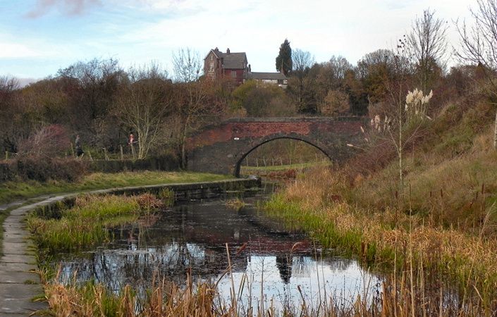
It is easy to break the trail into shorter and more manageable walks. For example, to split it into three sections of 4 to 6 miles (6.4 to 9.6 km) each, you could break the route at Lever Bridge (point 5 on the downloadable map) and at Clifton Country Park.
Accessibility and facilities
Both the Lancashire Wildlife Trust web page for the trail and the trust’s downloadable guide indicate which sections of the Kingfisher Trail are accessible. The trail is therefore rated as partially accessible for wheelchair-users and families with pushchairs.
Public toilets are available at various points along the route, such as Moses Gate Country Park in Bolton, Clifton Country Park in Salford . In addition, cafes and pubs can be found at various points along or near the Kingfisher Trail and are shown on the downloadable map and guide.
How to get there
The start of the trail at Jumbles Country Park is very close to Bromley Cross train station. The end of the route in Philips Park is approximately 1.5 miles/2.3 kms’ walk from either Besses o’ the Barn or Prestwich Metrolink stations. Moses Gate and other train stations are also not far from the route of the Kingfisher Trail
To work out how to get to and from the walk start point, end point, and other access points, simply click the Google Maps links shown on this page. Then click ‘Directions’ and enter your postcode or location in the relevant field. For public transport options, click the train icon.