Mersey Vale Nature Park is a local nature reserve (LNR) and a Site of Biological Importance owned and managed by Stockport Council. It is located on the south side of Didsbury Road beside the river Mersey and incorporating the Trans Pennine Trail West that passes along this section of the Mersey Valley.
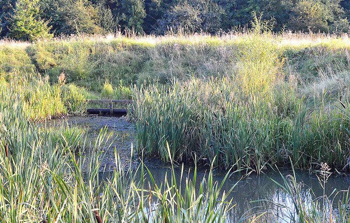
The downloadable map on this page – which has been created by the Heaton Mersey Conservation Group – shows the paths and features of the Nature Park. These include a traditional orchard, two ponds with dipping platforms, and a wildflower meadow all with picnic and seating areas. You can use the map to explore the area at leisure on a walk of up to 2 miles / 3.2 km or so.
Accessibility and facilities
The conservation group has advised us that some but not all of the footpaths within the nature park are accessible for wheelchair-users and those with pushchairs. We would therefore rate this walk as being partly accessible.
While there are no public toilets en route, there are several pubs and cafes in Heaton Mersey village just a short way to the north.
How to get there
The main start point listed is at Burnage Rugby Club, where, according to Stockport Council, parking is available. Bus services run just to north of here on the main Didsbury Road (A5145).
On this page, we also list on this page an alternative start point, on the street known as ‘Green Pastures’ shown on the bottom-right of the downloadable map. This is a very pleasant 0.6 mile / 1km walk east along the old railway line (National Cycle Route 55) from East Didsbury Metrolink station (which, in turn, is not far from East Didsbury train station). At the Metrolink station, simply walk on the paved traffic-free track eastwards from the end of the platform.
To work out exactly how to get to and from the walk start points, simply click the Google Maps link on this page. Then click ‘Directions’ and enter your postcode or location in the relevant field. For public transport options, click the train icon.