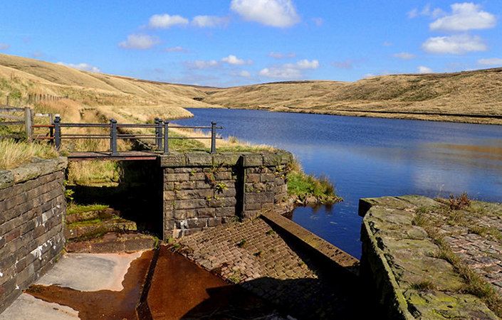
Those of us living in developed countries in the 21st century take it for granted that when we turn on the tap, fresh clean water will come gushing out. The South Pennines enjoys the greatest density of reservoirs in the country thanks to its natural geology of high ground and steep valleys which enable water catchment on a grand scale.
As part of the Watershed Landscape Project, Rochdale and Oldham Councils, along with reservoir owner United Utilities have worked together to develop a series of walks to help you explore the network of reservoirs and surrounding landscape in the two boroughs.
This walk explores visits three reservoirs in the dramatic Upper Denshaw Valley in Saddleworth. It also visits the remains of Dowry Castle on the slopes of Denshaw Moor. The walk can be extended by an additional 1.5-mile / 2.4-km there-and-back extension to the Rams Head Inn from Readycon Dene Reservoir, as shown on the downloadable map. If the walk is started from Denshaw Village, to which buses run, then this will add an extra 2 miles / 3.2 km (there and back).
Note that you are advised to use the relevant OS Explorer maps or the OS mapping app while completing this walk.
Accessibility and facilities
While many of the paths around the South Pennines reservoirs are well-maintained and surfaced, we have not been able to verify conditions on the ground. For this reason, we have not rated this walk as suitable for wheelchair-users and for families with pushchairs.
There are no public toilets or other facilities along the route, but the Rams Head Inn is accessible via the extension route indicated.
How to get there
Unlike most of the other walks in the Reservoir Trails series, the start point of this walk is not served by buses. However, there are regular services to Denshaw village, from where it is a 1-mile / 1.6-km walk along the Huddersfield Road (A640).
To work out how to get to and from the walk start point, simply click the Google Maps link on this page. Then click ‘Directions’ and enter your postcode or location in the relevant field. For public transport options, click on the train icon.