Salford Trail – overview
50 miles long
Overview
Explore the heritage, countryside and rural areas of Salford with this series of ten walks.
The Salford Trail is a new, long distance walk of about 50 miles/80 km and entirely within the boundaries of the City of Salford. It was devised by members of Manchester and Salford Ramblers in conjunction with Salford City Council and Transport for Greater Manchester.
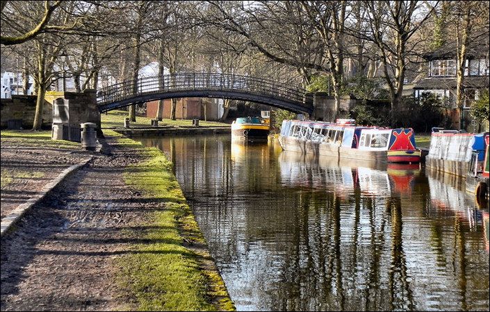
The route is varied, going through rural areas and green spaces, with a little road walking in between. Starting from the cityscape of Salford Quays, the trail passes beside rivers and canals, through country parks, fields, woods and mosslands. It uses footpaths, tracks and the disused railway lines known as the ‘Salford looplines’. The trail circles around to pass through Kersal, Agecroft, Walkden, Boothstown and Worsley before a branch heads off to Chat Moss. The main loop of the trail returns to Salford Quays from the historic Barton swing bridge and aqueduct.
The trail has been divided into ten sections, each accessible by public transport. There is a leaflet for each section describing the route and giving the transport options. These separate leaflets can be downloaded from the individual Salford Trail pages on this website.
Accessibility and facilities
While many sections of the route are likely to be suitable for wheelchair-users and for families with pushchairs, we have not been able to verify conditions on the ground. For this reason, we are not currently classifying this walk as wheelchair or pushchair-friendly.
Regarding public toilets, these are available at virtually all public libraries in Salford during opening hours (not, therefore, on Sundays). Similarly, the council’s Gateway Centres offer public toilet facilities during opening hours. In addition, Salford Council has compiled this list of accessible toilets. Finally, cafes and pubs along the route are likely to offer toilet facilities for customers.
How to get there
All of the walks on the Salford Trail are designed to be – and are most easily – accessed by public transport. For details, see each individual route description.
Although Salford Quays is given as the starting point for the whole Salford Trail, you can actually start the walk at a wide range of locations across the city. You can also ‘pick and mix’ from the various stages for an easy or leisurely short walk of your choice.
To work out how to get to and from the walk start point and end point, simply click the Google Maps links on this page. Then click ‘Directions’ and enter your postcode or location in the relevant field. For public transport options, click the train icon. Alternatively, input the postcodes shown on this page into the TfGM journey planner at https://my.tfgm.com/#/planner/
Individual stages
Stage 1
Salford Quays to Peel Park
Salford Trail 1
Stage 2
Peel Park to Kersal
Salford Trail 2
Stage 3
Kersal to Clifton
Salford Trail 3
Stage 4
Clifton to Roe Green
Salford Trail 4
Stage 5
Roe Green to Walkden
Salford Trail 5
Stage 6
Walkden to Worsley
Salford Trail 6
Stage 7
Worsley to Barton or Brookhouse
Salford Trail 7
Stage 8
Barton Bridge to Salford Quays
Salford Trail 8
Stage 9
Brookhouse to Irlam
Salford Trail 9 – Brookhouse to Irlam
Stage 10
Irlam to Cadishead
Salford Trail 10 – Irlam to Cadishead