This downloadable leaflet is one of a series that describes some easy walks around some of Oldham’s fantastic parks and countryside areas. They are designed to show you routes that can be followed until you get to know the areas and can explore some of the other routes and places within the parks.
Tandle Hill
Tandle Hill was used as a meeting area in the 19th century by political activists and the woodland was planted to prevent this.
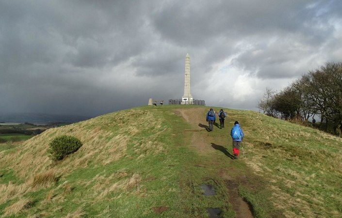
The area was donated to the people of Royton in 1919 as a peace offering at the end of the First World War. The war memorial was unveiled in 1921 at the park’s highest point and from here the Welsh Mountains can be seen on a clear day. The majority of the park is either beech woodland or open grassland and offers many pleasant walks either on formal footpaths or walks through the woodland.
The leaflet outlines two walks, both fairly short but which both include some steeper sections, including grass or steps. Therefore, while paths close to the visitor centre do appear to be well-surfaced and suitable for wheelchairs and pushchairs, the full routes are not listed as being accessible for all users.
How to get there
To work out how to get to and from the walk start point, simply click the Google Maps link shown on this page. Then click ‘Directions’ and enter your postcode or location in the relevant field. For public transport options, click on the train icon.