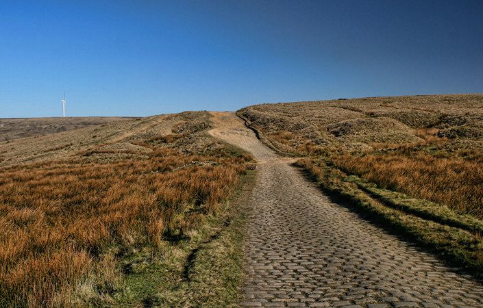
This walk takes you up the Cheesden Moors, scaling Turf Moor initially and ending with the ascent to the trig point on Knowl Hill. Starting at the Ashworth reservoir opposite the famously haunted ‘Owd Betts’ public house, this is a great way to explore the wind farm at Scout Moor whilst enjoying the solitude away from the nearby conurbations. The route also skirts around the highest point of the Forest of Rossendale – Hailstorm Hill.
One feels on top of an entire City during the long descent back down the Pennine Bridleway when over the Rossendale border, while somehow in the total quiet of the Greater Manchester countryside. Be prepared for some breathtaking views that stretch as far as the Cheshire plain on these under-explored paths.
According to the walk description, it has been reported that moto-cross bikes have cut up the path in places on this walk making progress difficult.
Accessibility and facilities
Although the route is classed as “moderate” on the Walking Britain website, we would rate it as “challenging” in view of the high and remote ground covered and the variable terrain in places. This makes it unsuitable for wheelchair and pushchair-users.
While there are no facilities en route, the historic “Owd Betts” pub is close to the start/end point of the walk.
How to get there
The walk starts and finishes on the remote Edenfield Road, near Owd Betts public house. This is shown as the main start point and is served on weekdays only by very infrequent buses. However, there is a much more frequent bus service to the White Lion bus terminus in Norden (postcode OL12 7SS). This will add another 3.4 miles / 5.5 km round trip to the total distance
To work out how to get to and from the walk start point, simply click the Google Maps link on this page. Then click ‘Directions’ and enter your postcode or location in the relevant field. For public transport options, click the train icon.