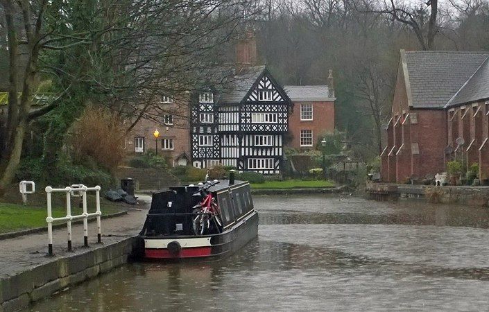
This 3-mile circular walk around Worsley takes in the picturesque village, the Bridgewater Canal with its fascinating heritage, and explores the rich woodland area of Worsley Woods.
Along the way, you will along the Bridgewater Canal. A walk along the banks of the canal is a journey to the past and a glimpse into the future. Every stretch of the waterway has a story to tell us about human ingenuity, endurance and events that shaped both Salford and the world. This is a place of global importance. For further details, visit http://www.est1761.org/
Accessibility
Because there are some slopes and we have not been able to verify conditions on the ground, this walk is not currently rated as wheelchair and pushchair-friendly. However, we believe that much of the route, particularly within Worsley village, offers good accessibility.
How to get there
The nearest train station is at Walkden, from where the most pleasant walking route uses the Roe Green Loopline, a tree-lined disused rail line. This will bring you to a point just east of Old Warke Dam in the route description (look out for signposts). However, this option will add an extra 3 miles / 5 km to the overall route. There are also frequent buses to Worsley village from Manchester and Salford.
To work out how to get to and from the walk start point, simply click the Google Maps link on this page. Then click ‘Directions’ and enter your postcode or location in the relevant field. For public transport options, click on the train icon.