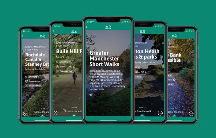
Greater Manchester Short Walks – Now on the Go Jauntly App!
19/09/2021
Greater Manchester Short Walks for wellbeing
Nature is the key to better mental wellbeing:
New “wellbeing walks” launched across Greater Manchester
Would you like to find out how to set up a walk on the Go Jauntly app, and perhaps with a focus on enabling people with physical or mobility issues to have the confidence to follow your walk route? Next workshop TBC
Together with Go Jauntly, Walking Projects CIC, and local community organisations across Salford, Manchester, Oldham, Rochdale and Bolton, we’ve created a series of new wellbeing walks across Greater Manchester.
It is recognised that walking in and around nature for at least 20 minutes a day is vital for both physical health and mental wellbeing. Walking is fun, free and easy. It’s one of the easiest ways to be a little more active and it can boost your overall well-being. At least 50% of these walks are step-free and so will appeal to wheelchair users and to families with pushchairs.
These brand new Greater Manchester walking routes are available for FREE on the Go Jauntly walking app and you can even download them in advance so that they are available in offline mode (saving your mobile data costs). Hurrah!
To date (February 2021) we have a total of 30 walks now on the app to explore across Greater Manchester.
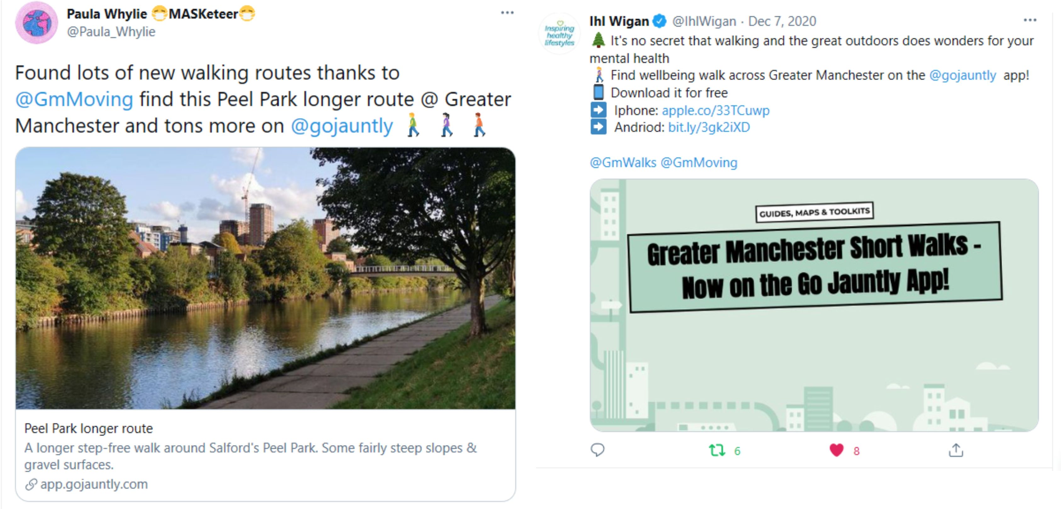
Here’s some of the ways that people have shared info about the walks on social media.
Follow us @GMWalks and tag us in your walking posts, so we can spread the word!
Download the Go Jauntly App onto your phone:
![]()

Here’s the full list of Greater Manchester Short Walks:
SALFORD
A step-free stroll around Buile Hill Park. There are accessible parking bays near the start.
Can be walked in 30 mins (1.6km)
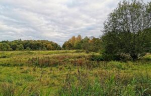
A level stroll through the new Kersal Wetlands, a haven for wildlife in Salford. Mixed surfaces.
Can be walked in 1hr (2.7km)
A longer step-free walk around Salford’s Peel Park. Some fairly steep slopes & gravel surfaces.
Can be walked in 50 mins (2.3km)
A wheelchair-friendly wander around Salford’s beautiful and historic Peel Park
Can be walked in 45 mins (2km)
An accessible walk from Blackleach Country Park around a landscaped former mining area.
Can be walked in 1hr (3.1km)
A circular walk connecting peaceful havens of greenery around Irlam. Some rough paths & slopes.
Can be walked in 1hr 50mins (5.3km).
A fine circular walk to Worsley Village. Good surfaces but 1 or 2 narrow pavements & brief slopes.
Can be walked in 1hr 55mins (5km).
MANCHESTER
A level stroll around Newton Heath, featuring the canal, two parks and traffic-free paths.
Can be walked in 50 mins (2.2km)
An easy trail through Newton Heath’s Brookdale Park, accessible for wheelchair and pushchair users.
Can be walked in 25 mins (1.1km)
A jaunt around Crumpsall, Manchester, including the lovely park and some lesser-known paths.
Can be walked in 40 mins (1.7km)
A walk around Crumpsall including two parks and a pretty church. Some gradients & awkward gates.
Can be walked in 55 mins (2.6km)
Collyhurst Parks & Valley walk
Well made paths and greenery with some steps and slopes. Lovely river and city views.
Can be walked in 1 hr 10 mins (3km).
A virtually step-free walk through Sandhills & Sand Street Parks. Includes a shorter version.
Can be walked in 50m (2.4km).
A step-free stroll around Ancoats & New Islington. Mill buildings & water-side paths, bars & cafes.
Can be walked in 40m (1.6km).
A walk from Ancoats along the green Medlock Valley with an (almost) step-free option. Some slopes.
Can be walked in 1hr 10mins (3.1km).
OLDHAM
A step-free walk around the beautiful Alexandra Park, with its lakes, trees and monuments.
Can be walked in 30 mins (1.3km)
An exploration of the 160-acre Northern Roots eco-park site. Slopes, steps & mud but great scenery!
Can be walked in 1hr 40 mins (3.7km)
BOLTON
A walk around Moss Bank Park to the north of Bolton. Well-made paths. One section shared with cars.
Can be walked in 40 mins (1.4km)
A circular exploration of Bolton’s lovely Queen’s Park. No steps & hard-surfaced paths but some slopes.
Can be walked in 45 mins (2km)
A circular walk full of scenic interest with lakeside, river and woodland views. A few steps and rougher paths.
Can be walked in 40 mins (1.8km)
A surprisingly varied step-free walk around Farnworth’s Central Park. Good paths but a few slopes.
Can be walked in 35 mins (1.3km)
An exploration of a picturesque country park. Moderate slopes but some muddy, uneven & narrow paths.
Can be walked in 55 mins (2.7km)
Queen’s Park Heywood step-free
A step-free exploraiton of a gorgeous park. Lovely lakes, play areas & a cafe. A few short slopes.
Can be walked in 35 mins (1.1 km)
ROCHDALE
A moderate walk around Middleton’s beautiful Alkrington Woods. Some ups & downs and rough surfaces.
Can be walked in 1hr (3km)
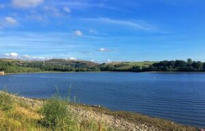
Hollingworth Lake step-free walk
A circuit of lovely Hollingworth Lake. Fully paved to the halfway point then a well-made dirt track
Can be walked in 1hr 30 mins (3.7km)
Rochdale Canal & Stanney Brook
A lovely walk from kingsway Metrolink. A few steps & barriers but should be OK for pushchair users.
Can be walked in 45 mins (2.3km)
A step-free wander around the lovely Falinge Park & neighbouring Cronkeyshaw Common. Some slopes.
Can be walked in 45 min (2.1km)
BURY
A lovely circuit with a canal, reservoir & country views. Mainly level paths but muddy in places.
Can be walked in 1hr 35mins (4.7km).
A leisurely stroll along part of the Outwood Trail & Irwell Valley. A few steps & muddy parts.
Can be walked in 1hr 5mins (3.2km).
WIGAN
A circular walk from Leigh including country paths and the Liverpool Leeds Canal. Some slopes & mud.
Can be walked in 2hr 15mins (6.3km).
Do you have any more walks you think would be good to add? You can easily create your own walk on the app for others to enjoy. Find out more about creating the ultimate walk or get in touch if you need any help.
![]()
Frequently Asked Questions about the Go Jauntly App
Q: Would there be an option to integrate geocaching into the app? We think this is a great initiative and will certainly implement it into our guided walks
It’s not available in the current app but it is possible to work with us to include extra content features such as quizzes, audio, and additional interpretative content. These features would work well for things like treasure or scavenger hunts.
Q: Is the ‘Nature Notes’ feature on Android? Can’t see it on the app sorry
A: Nature Notes is coming to Android in Spring 2021.
Q: Does the ‘Circular’ option (currently on iOS) allow you to enter in a distance or duration you wish to walk for from your location?
A: Yep 🙂
Q: Once I add some personal routes like ‘Routes for Claud’ (currently iOS only), are those routes visible to all or just visible to me as a user? Or is there an option to keep it private or public?
A: Routes for you are just for you only. Those are dynamic and not created by you per se, they are made for you. They are private.
You can share routes with friends and family if you wish. The link will expire after 7 days to help protect privacy.
Q: How do you make the walk you create private or public?
A: When you publish, it will become public, once we have checked it at GoJauntly HQ and are sure it’s a good-quality walk.
Q: For walk features could you develop the app to add in something like ‘Pram friendly’ too?
A: “Wheel-friendly” is a filter you can use to find these type of walks. We also have a “Child-friendly” filter
Q: Is there scope to add information regarding public transport links close to start/end points?
A: Yes, quite often, people add sustainable transport options as part of their walk. You can include nearby stations, bus stops etc. as steps on your walk.
Q: Would it be possible on the map to have the function that you click on the number and it tells you what is located there please? Hope that makes sense
A: Yes, that’s available on iOS and coming to Android next year.
Q: If you are recording a walk, won’t the time be too long because of the stops to log to the app?
A: No, it records the time based on the distance, not the time you’ve taken to record it. So we would recommend adjusting the time if you feel it’s inaccurate.
Q: Hi there, just curious about the amount of mobile data the app uses? Can a route be downloaded at home on Wi-Fi and used offline?
A: The GM Walking routes are all available to download offline for free, wherever you have WiFi, and then you don’t need data.
There is an optional premium subscription for £1.99 a month that unlocks extra walks and the offline feature for all the other walks. The GM Walking routes are free.
Q: Really interested in the GM Walking routes. Couldn’t find any around the Wigan borough though. Plans to fill this gap or aim is gaps will be filled via people uploading routes individually?
A: The first walks we’ve added have been in Salford, Bolton, Manchester, Oldham and Rochdale as that’s where the local teams were keen to work with us. We are hoping that, now we’ve added the first walks, others in Wigan and other boroughs will add extra ones.
Q: There is a constant message ‘Upgrade to Premium’. Do you need to upgrade to load routes etc ?
A: No, you don’t need to upgrade. We do ask people to register so they can save routes. The app is free to access and nearly all the walks are free. There is an optional premium subscription which helps support our small business and unlocks “offline mode” for all walks and unlocks specially curated tours. GM walking routes are all free to download offline 🙂 The optional fee is £1.99 a month or £19.99 a year (10 months for the price of 12 months).
Q: Only downloaded the app just now and keen to record some walks around Stockport. So who would be the best person to contact via email to get any help getting started?
A: Feel free to contact us at GM Walking via email: info@gmmoving.co.uk. Or email Go Jauntly hi@gojauntly.com or Andrew of Walking Projects Plus CIC Andrew@WalkingProjects.com if people need help with this or other ideas for walking projects.
Q: Can you include link-outs to website, groups or organisations?
A: We have the ability to create in-app adverts to link to local groups e.g. link to website or a Facebook group. Please contact Go Jauntly at hi@gojauntly.com if you want to discuss this.
Q: Is there a limit to how many walks an individual profile can add to the app?
A: Nope! 🙂
Q: Can I record a walk in any weather conditions?
A: In theory, yes, but if you are taking photos and recording the route ‘on the ground’, we’ve found it best to avoid rainy conditions, simply because smartphone screens tend to be less responsive. Also, your photographs will look better in good weather!
Q: Sometimes, on Android, when I take or add a photo for a walk step and then click the screen to add the text, the screen freezes and I can’t add any words. What should I do?
A: We’re working to resolve this issue, but there is a quick and easy workaround! Simply add an extra ‘Text step’ after the step you’re working on and then go back to that step and add your words. You can then leave this final empty text step there as you add steps and this resolves the problem. When you’ve finished, you can then delete the empty text step.
Q: I’ve noticed that sometimes the incorrect location is recorded for some walk steps. How can I resolve this?
A: Unfortunately, the accuracy of the location will depend on the accuracy and speed of your phone’s GPS (‘Global Positioning System’). The strength of the GPS signal can also vary depending on your location. For this reason, whenever you create a new step by adding a photo and words, it’s best to check the location by clicking the ‘Location added’ button (to the bottom right of each step). You’ll then see the map. If the current step is in the wrong place, simply click ‘Change location’, move the pin with your thumb, and click ‘Save’.
How are the routes being seen and used? (October – December 2020)
The combined total reach of the GM Walking routes in the first three months is close to one million, due in large part to prominent coverage in local press in mid-December. The usage and reach numbers are also particularly impressive considering strict local restrictions due to Covid-19.
‘Reach’ is the number of eyes the routes and content was exposed to via the app, social media, press and other marketing. The GM total reach figures are high and demonstrate that we have been able to reach a growing audience in the first 3 months of the GM routes being added to the app!
Total reach (combined app, web, social media and press reach): 968,105
Highlights:
- App of the Day – 22nd Nov 2020 & 27th Dec 2020
- Wintry Walks feature on the App Store – 26th Dec 2020 for several days
- I Love Manchester
- Manchester Evening News
- Guardian
- Techcrunch article – new green routes feature on iOS
Active users 2,215
Walk – offline trail downloads 193
The GM walks have been ‘saved for later’ by 217 users.
The Ancoats accessible route in Manchester has been the most walked route so far with 40 total users, followed by the Kersal Wetlands route in Salford with 35 total users.