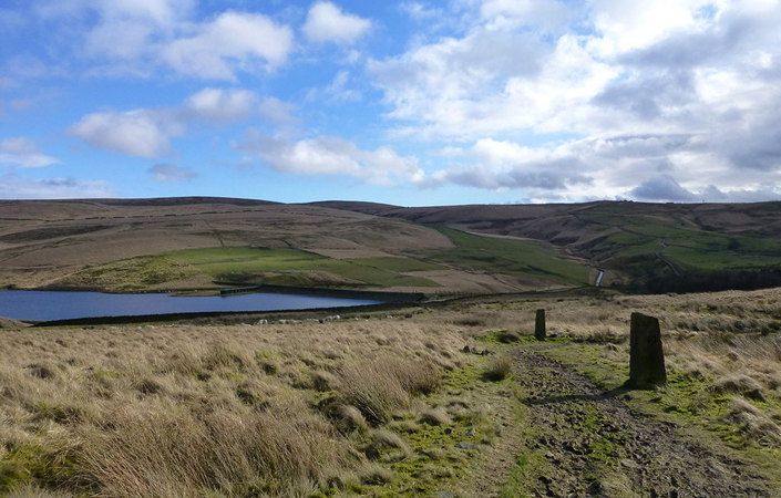
The Rochdale Way is a fabulous 45-mile / 72-km circular walk around Rochdale borough. It visits a series of lovely reservoirs and includes a section along the River Roch. The walk visits Blackstone Edge, Healey Dell, Knowl Hill, Ashworth Moor Reservoir, and the Ashworth Valley, where there are lovely trails along Naden Brook and Cheeseden Brook. Other highlights include Tandle Hill Country Park, Queens Park and the Ogden and Piethorne Reservoirs in the Piethorne Valley. While there are several challenging climbs, walkers are rewarded with splendid views of the area.
Unfortunately, the original guidebook to the route has not been updated in recent years and is difficult to obtain. However, in 2011, Steve Baker of East Lancs Long-Distance Walkers Association retraced the route and updated the directions. You can download these revised directions from this page in PDF format. These include very basic maps, offered simply to give an overview of each stage. You will therefore definitely need to use the relevant OS Explorer maps or the OS mapping app. The Rochdale Way is still shown on most Ordnance Survey maps.
As the route involves highly varied terrain and a considerable number of ascents and descents, it is not rated as suitable for wheelchairs or pushchairs. Most sections are suitable only for experienced and properly equipped walkers.
There are a number of pubs and some cafes along the route.
How to get there
Walkers can choose which sections of the Rochdale Way they wish to walk and where to access it. On this page, we give the official start point at Hollingworth Lake Visitors Centre, which is not far from Littleborough and Smithy Bridge rail stations. Other parts of the route pass close to Broadley (north of Rochdale town centre), Norden, Heywood, Middleton and Newhey, ensuring that the route is easily accessed by public transport.
To work out how to get to and from the walk start point, simply click the Google Maps link on this page. Then click ‘Directions’ and enter your postcode or location in the relevant field. For public transport options, click on the train icon.