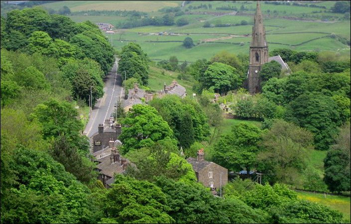
Village Link – overview
18 miles long
Overview
The Village Link is a unique trail of a little less than 18 miles / 29 km around and between six of Bury’s most historic villages. The trail consists of several quite distinct separate sections, each varying in length and scenery, and each from 2 to 5 miles (3.2 to 8 km) long. The trail is ideal for everyone, from seasoned walkers to weekend strollers.
In addition to the overall route map, each section comes with its own colour-coded, user-friendly, individual map. These maps and guides can be downloaded in two versions for each section (one in one direction, and one in the other). They show not only the route, but all the places of interest along it including picnic sites, viewpoints and even the whereabouts of the occasional public bench to rest tired legs and aching feet.
The written route descriptions that accompany and compliment the maps also provide an interesting narrative on the local history and on any other points of interest along the trail. They include public transport connections at either end of the section, a guide to the degree of difficulty of each walk and an estimate of the time to complete each walk (in a leisurely manner). Finally, also listed are all the family-run cafes and 18th and 19th century inns en route as well as any public toilets on each section.
You may enjoy starting at one village, walking to the next one you fancy, then simply walking back to your starting point, enjoying the different views on the way back. Both sets of directions are flagged up for you. All the routes are 100% waymarked to avoid any confusion – look out for the green and white discs marked ‘Village Link’.
Accessibility
Although individual sections will include level and well-surfaced accessible sections, there is also a wide variety of terrain on the various parts of the Village Link. For this reason, we are not currently rating these walks as suitable for wheelchair and pushchair users.
How to get there
As the Village Link is a multi-stage trail, you can complete sections in any order. We have given Greenmount Village as the start point here, as it is close to the geographical centre of the circular trail and benefits from excellent bus connections from Bury.
To work out how to get to and from the walk start point, simply click the Google Maps link shown on this page. Then click ‘Directions’ and enter your postcode or location in the relevant field. For public transport options, click the train icon.
Alternatively, input the postcodes shown into the TFGM journey planner at https://my.tfgm.com/#/planner/
Individual stages
Walks 1 & 2
Hawkshaw to Holcombe (or reverse)
Village Link Walks 1 & 2
Walks 3 & 4
Holcombe to Ramsbottom to Park Farm (or reverse)
Village Link Walks 3 & 4
Walks 5 & 6
Park Farm to Nangreaves to Rowlands Road (or reverse)
Village Link Walks 5 & 6
Walks 7 & 8
Rowlands Road to Greenmount (or reverse)
Village Link Walks 7 & 8
Walks 9 & 10
Greenmount to Walshaw (or reverse)
Village Link Walks 9 & 10
Walks 11 & 12
Walshaw to Ainsworth (or reverse)
Village Link Walks 11 & 12
Walks 13 & 14
Ainsworth to Affetside to Hawkshaw (or reverse)
Village Link Walks 13 & 14